N3/M50 UAV Aerial Topographical Survey
Project overview
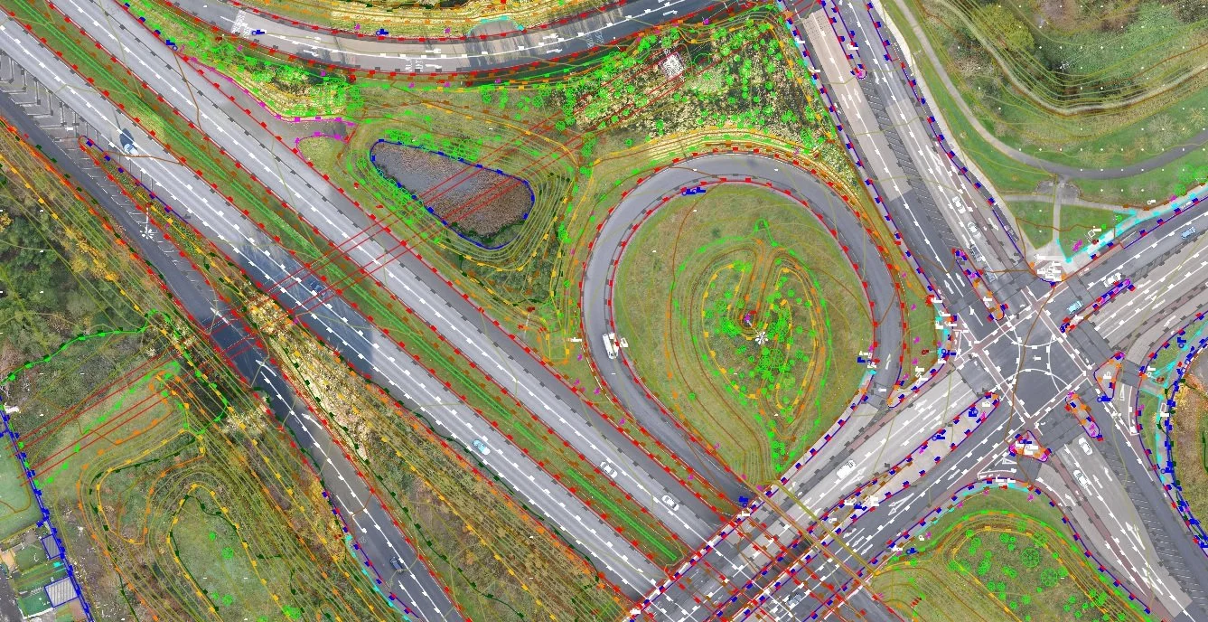
This project consisted of an aerial UAV survey of the N3 corridor from the M50 motorway to Clonee, Co. Meath. The area of interest was 7.5kms long and with an area of 385 Hectares. We used our SenseFly EbeeX fixed wing drone to carry out the survey over a number of days from 5 carefully chosen take-off/landing locations. This lightweight and strong UAV with steep landing capability was perfect for safely taking off and landing in urban locations within the survey area. The survey was carried out safely and delivered on time by our UAV team who have over 20 years’ experience in producing aerial surveys.
Project solution
The aerial survey and ground control were carried out utilising a variety of methods and technologies including using Trimble R12 GNSS receivers and Sensefly Ebee X fixed wing UAV.
A full geo-referenced 5cm pixel orthophoto was captured for the area of interest.
A detailed 1:500 scale topographical survey with 0.5m contours was delivered in AutoCAD format. A 5m grid of levels was also included with this output.
A GPS check survey of 100 points was surveyed on the ground and used to ensure quality control of the final product delivered to the client.
Project accuracies - Horizontal accuracy of +/-50mm for hard detail such as buildings, roads and walls and +/-75mm for soft detail such as vegetation and surface changes. Vertical accuracy (levels) +/-75mm for hard detail and +/- 100mm accuracy for soft -detail.
Project delivery
2D/3D Topographical Survey with Orthophoto background in AutoCAD format.
Ortho photo in GeoTIFF format.
TIN Model in AutoCAD format.
5m Grid in ASCII format.
Gallery
Click images to expand.