N6 Bothar Na dTreabh and N83 Tuam Road topographical survey
Project overview
Topographical survey of pavement and topographical survey of verges for design of pavement overlay. The project area was 6 kms long and included the N6 Bothar Na dTreabh and N83 Tuam Road which are some of the busiest roads in Galway City. The project was surveyed and delivered in 4 weeks.
Project solution
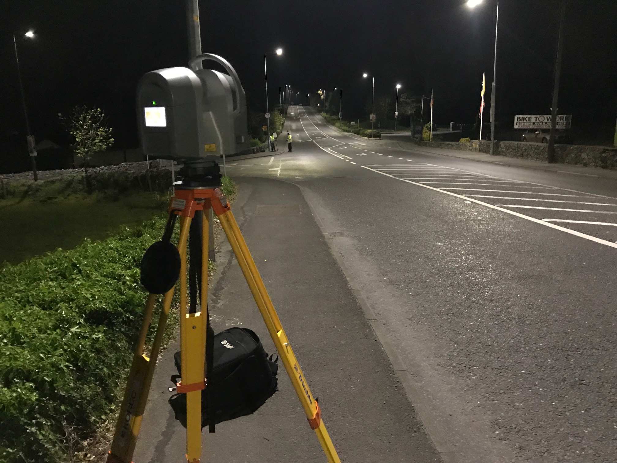
Surveys carried out utilising a variety of methods and technologies including using precise levelling, Trimble S6 robotic total station, Trimble R10 GNSS receivers and Trimble TX8 laser scanner.
The final survey accuracy was +/- 5mm. This was achieved by using the Trimble TX8 laser scanner setup over permanent control stations installed every 100m along the route.
The verges were surveyed using total station and GNSS methods depending on sky visibility.
Due to the extremely busy nature of the roads involved a lot of the work was carried out at night for safety and logistical reasons
All traffic management was in compliance with Chapter 8 guidelines.
Project delivery
3D AutoCAD survey.
TIN Model in AutoCAD format.
Detailed survey report in word format.