N22 Corranamaree Pavement overlay survey
Project overview
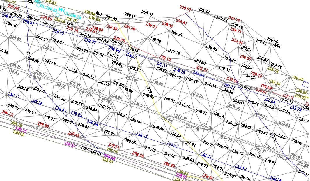
Laser scan survey of pavement and topographical survey of verges for design of pavement overlay. The project area was 3.3 kms long and was located on the N22 North of Killarney at the Kerry/Cork border. The project was surveyed and delivered in 4 weeks.
Project solution
- Surveys carried out utilising a variety of methods and technologies including using precise levelling, Trimble S6 robotic total station, Trimble R10 GNSS receivers and Trimble TX8 laser scanner.
- The final survey accuracy was +/- 5mm. This was achived by using the Trimble TX8 laser scanner setup over permanent control stations installed every 50m along the route.
- The verges were surveyed using total station and GNSS methods depending on sky visibility.
- All traffic management was in compliance with Chapter 8 guidelines.
Project delivery
- 3D AutoCAD survey.
- P,E,N,Z,D ASCII format.
- Point cloud in LAZ format.
- MX Genio.