Eden Quay laser scanning survey
Project overview
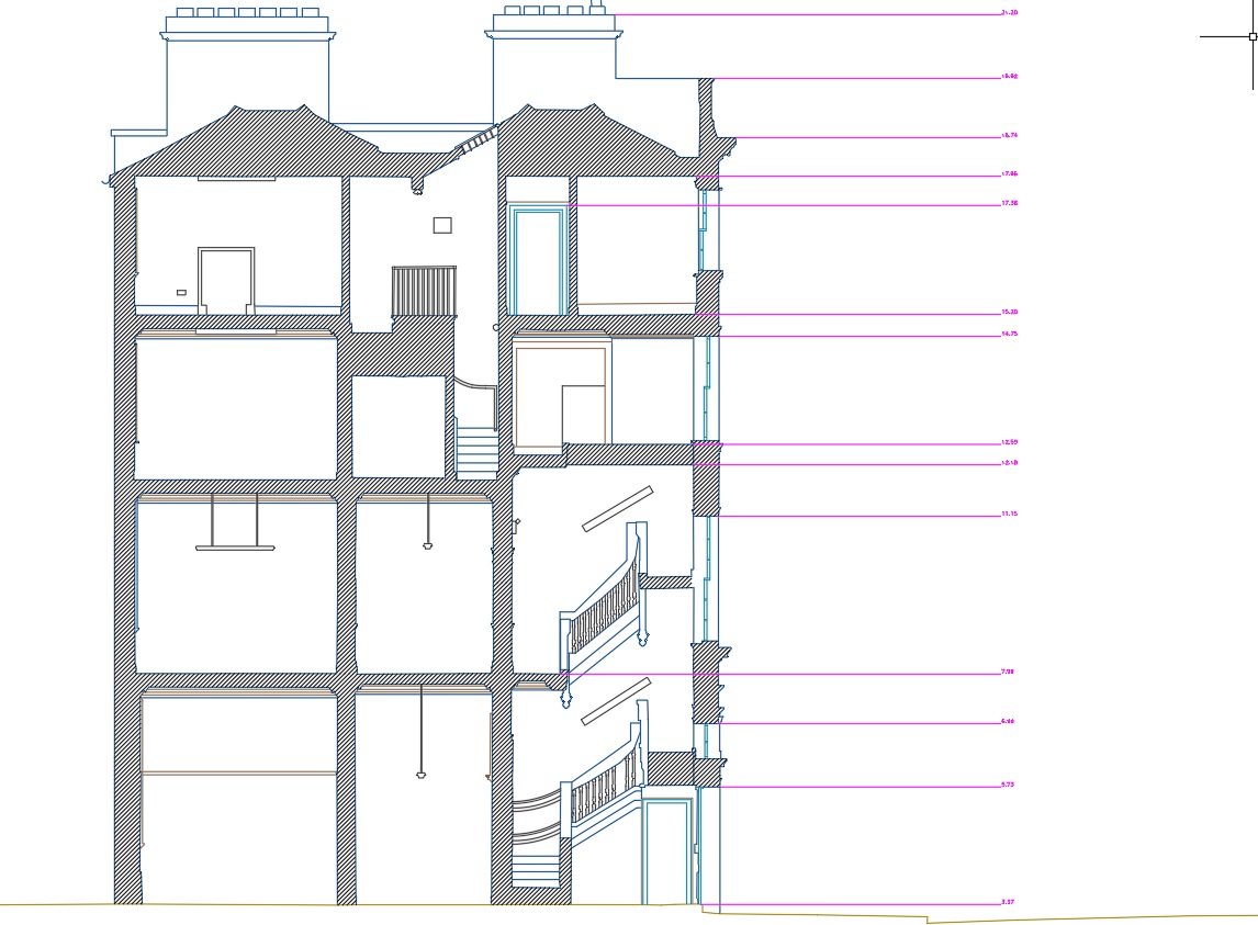
Laser scanning survey of buildings at Eden Quay, Dublin. The project consisted laser scanning to produce a topographical survey, measured building survey, elevations and sections for architectural purposes. The project was carried out and delivered over a 3 week period.
Project solution
Surveys carried out utilising a variety of methods and technologies including using Trimble S6 robotic total station, Trimble R10 GNSS receiver, Trimble TX8 laser scanner and Nodal Ninja camera system.
High definition 360 degree photography was also captured at each set-up to to act as a photographic record.
A Trimble Realworks virtual model was also delivered to the client free of charge. The model can be view using an Internet explorer web browser version 8 or newer.
A detailed colour point cloud was also delivered to the client.
Our crews also worked out of hours to carry out the laser scanning and topographical surveys on Eden Quay which can be extremely busy during normal working hours.
Project delivery
Colour point cloud in E57 format.
Topographical survey, measured building plans and sections in AutoCAD format.
Gallery
Click images to expand.