Foynes Station Revit modelling, Topograpichal and GPR Survey
Project overview
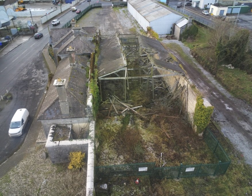
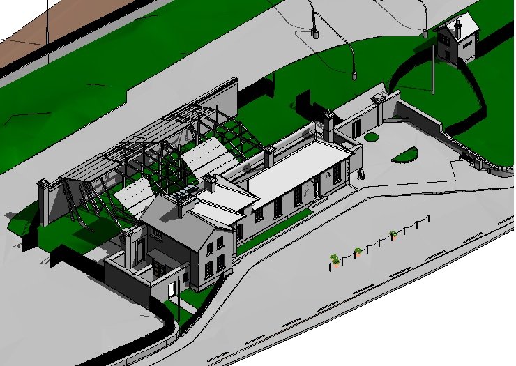
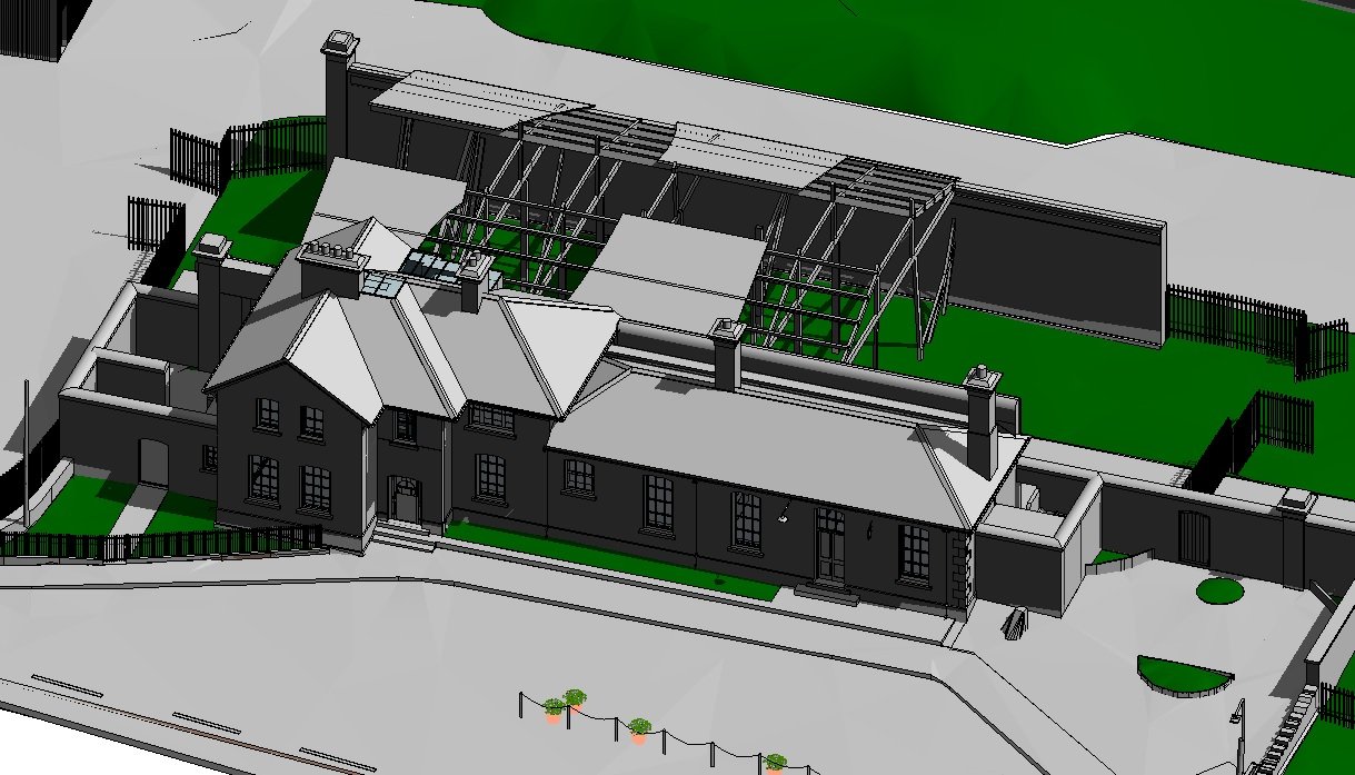
This project consisted of producing a BIM model (LOD300), Topographical survey and GPR/Utility survey of Foynes Railway Station County Limerick. The works were carried out as part of the re-opening of the Foynes to Limerick Railway line to enable Iarnrod Eireann to restore the station to its former glory. The survey was carried out using a variety of techniques consisting of laser scanning, total station, GPS and GPR to produce detailed Revit modelling along with a conventional 3D AutoCAD dwg of all over ground and under ground features. As the roof was unsafe to access this was surveyed by drone and then combined with the laser scanning point cloud to enable accurate extraction of the 3D Revit model.
Project solution
The station was surveyed using a Trimble X7 laser scanner with point cloud registrations done on site and checked back at the office. This speeded up the delivery process.
A full ground survey and GPR/Utility surveys were also undertaken using conventional survey techniques.
A detailed 1 cm pixel orthophoto was captured for the whole area interest. The roof was also captured and we produced a point cloud in E57 format to be used for Revit modelling.
A detailed high accuracy ground topographical survey in AutoCAD was produced for the station and surrounding property areas.
In addition to the ground topographical survey we produced building elevations and cross sections in AutoCAD format.
We also delivered the point cloud and 360 photos to the client using an online viewer. This enabled designers to virtually look at the whole site in detail without having to make site visits.
Project accuracies Aerial - Horizontal accuracy of +/-20 mm for hard detail such as buildings, roads and walls. Vertical accuracy (levels) +/-30 mm for hard detail.
Project accuracies Ground - Horizontal accuracy of +/-10mm for hard detail such as buildings, roads and walls and +/-15 mm for soft detail such as vegetation and surface changes. Vertical accuracy (levels) +/-5 mm for hard detail and +/- 25 mm accuracy for soft -detail.
Project delivery
2D/3D Ground Topographical Survey , GPR Utility Surveys and MBS outputs in AutoCAD format.
LOD 300 Revit model.
Ortho photo in GeoTIFF format.
Online viewer for Point cloud and 360 photos.
Provision of survey report..
Gallery
Click images to expand.